
Page 195 - GIS for Science, Volume 3 Preview
P. 195
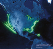
 An ArcGIS web application illustrates vessel traffic monitored by a navigation device called the Automatic Identification System (AIS) By assembling vast reams of breadcrumb-
like information, AIS helps identify and resolve space use conflicts, and much more.
