
Page 16 - GIS for Science, Volume 3 Preview
P. 16
Nord University Land Change Science Program
EARTH’S COASTLINES
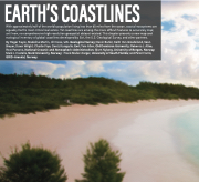
With approximately half of the world’s population living less than 65 miles from the ocean, coastal ecosystems are arguably Earth’s most critical real estate. Yet coastlines are among the more difficult features to accurately map; until now, no comprehensive high-resolution geospatial dataset existed. This chapter presents a new map and ecological inventory of global coastlines developed by Esri, the U.S. Geological Survey, and other partners.
By Roger Sayre, Madeline Martin, Jill Cress, U.S. Geological Survey; Kevin Butler, Keith Van Graafeiland, Sean Breyer, Dawn Wright, Charlie Frye, Deniz Karagulle, Esri; Tom Allen, Old Dominion University; Rebecca J. Allee, Rost Parsons, National Oceanic and Atmospheric Administration; Bjorn Nyberg, University of Bergen, Norway; Mark J. Costello, Nord University, Norway; Frank Muller-Karger, University of South Florida; and Peter Harris, GRID-Arendal, Norway.
4 GIS for Science
